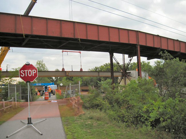
In 1915 New York State dammed the Mohawk River, creating the Barge Canal to replace the Erie Canal, opened on October 26, 1825, which had its own right-of-way alongside the river. The resultant rise in water level caused the mouth of the Lisha Kill to become a back bay, cutting off access to the inhabitants of Niska Isle. Therefore a bridge was built by New York State on Ferry Road, over the New York Central railroad tracks to the now isolated peninsula. (Originally the Schenectady and Troy Railroad, incorporated May 21, 1836, it was consolidated into the New York Central in 1853.) Over the years the steel bridge deteriorated while the railroad was abandoned and replaced by the Mohawk/Hudson Bike/Hike Trail. The State owner of the bridge which served the 9 households on the peninsula attempted to purchase the properties, offering over 6 million dollars. The offer was rejected and the State built the new bridge (removing the old) at about the same cost. The following photos taken from the Bike Path are of the original and the new bridge completed in 2010.
![]()
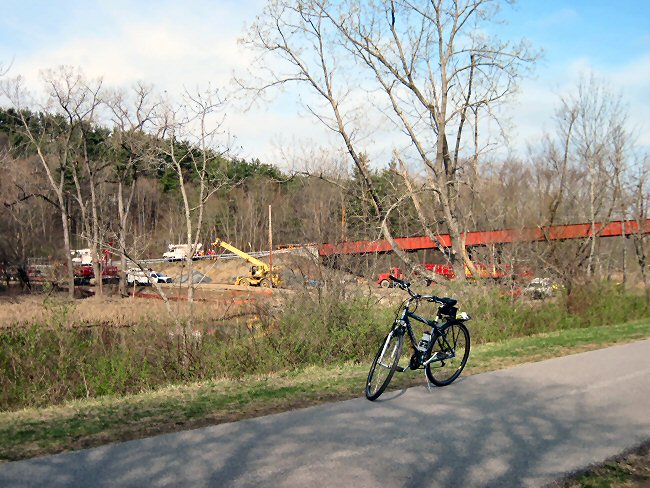
Construction starting on the new bridge. The contractor is building a temporary road to build the bridge piers. To the left is River Road and my Trek bicycle is on the Bike Path. The photo was taken on March 7, 2010.
![]()
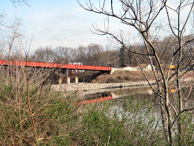
View toward Niska Isle on the right. You can see the crushed stone temporary fill in the Lisha Kill back bay to facilitate the construction of the piers. The photo was taken on March 7, 2010.
![]()
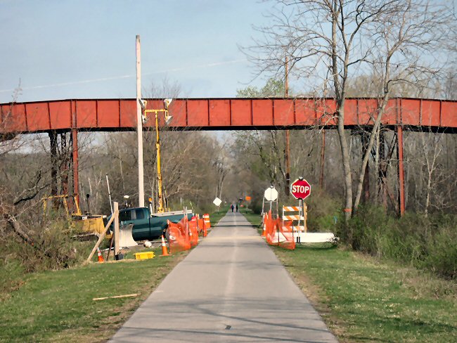
The Bike Path looking West. The truck is parked where the temporary road crosses the Path. The photo was taken on March 7, 2010.
![]()
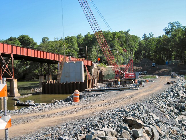
A later view of the temporary fill and one of the piers nearing completion. The photo was taken on May 1, 2010.
![]()
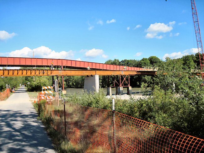
Looking East on the Bike Path as workers place the beams for the new bridge. The photo was taken on July 26, 2010.
![]()
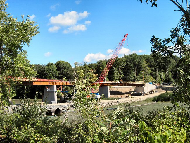
A view of the progress of bridge construction. Note the twin culverts in the crushed stone fill to accomodate the Lisha Kill flow. The green you see in the right foreground is the invasive species water chestnut filling the shallow Niska Isle back bay and extending to where it joins the Mohawk River. This photo was taken on September 4, 2010.
![]()
Another view of the new bridge looking West. Note the lower clearance of the new bridge which doesn't need the height to clear railroad cars. This photo was also taken on September 4, 2010.
![]()
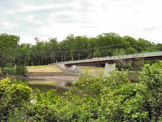
Looking toward the Northeast. The old bridge is no more. Workers on the new bridge are doing finishing touches on the railings. The bridge is open for traffic. This photo was taken on May 25, 2011.
![]()
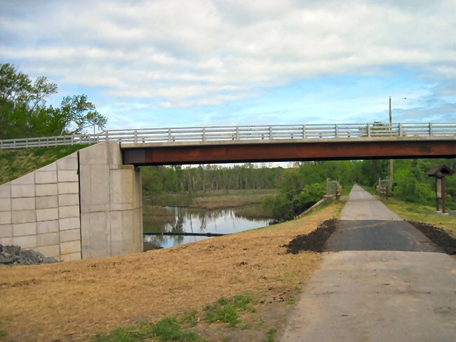
Looking West under the completed bridge. The Bike Path has been newly blacktopped and the shoulder of the temporary road seeded. On the left is a large wetland which has many ducks and geese in season. The fence on both sides of the Path was the original bridges location. This photo was taken on May 28, 2011.
![]()
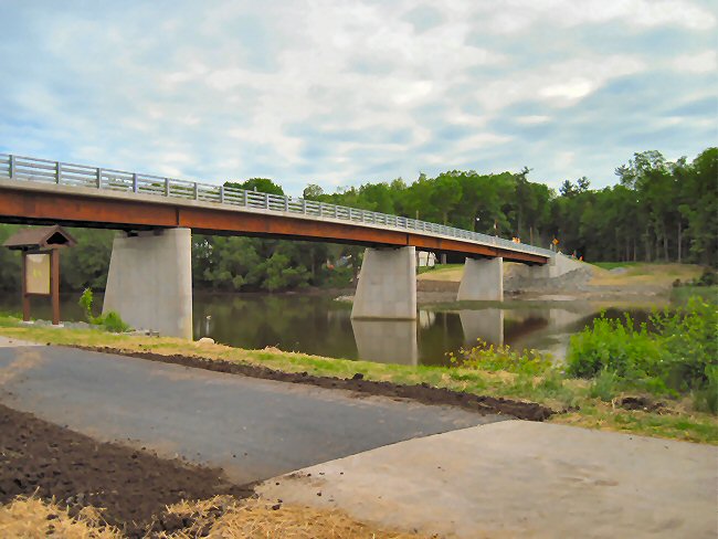
A final view from the Eastern side of the completed structure. Note the meticulous removal of the crushed stone temporary road and the neat clean-up of the Path. This photo was taken on May 28, 2011.
![]()
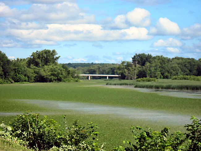
Looking West toward the new bridge from Forts Ferry Lions Park. The park, site of the old Forts Ferry Schenectady and Troy Railroad station, has a fine parking lot and complete facilities. Photo taken on June 27, 2011.
![]()
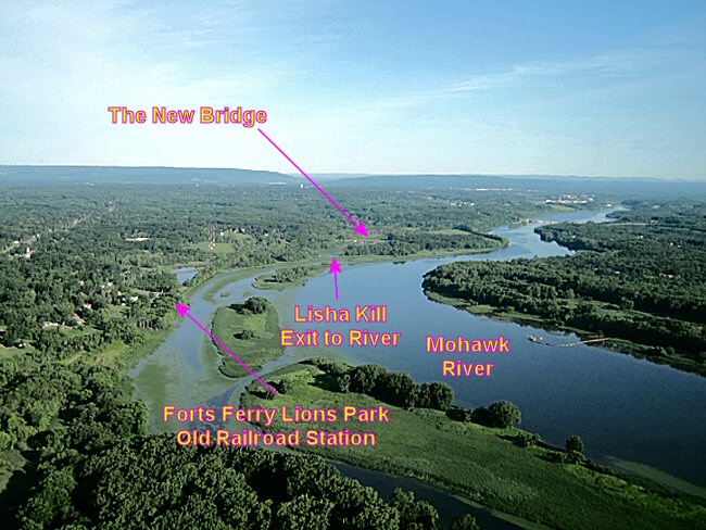
Aerial view looking West on takeoff from Albany International Airport. From the air you can see how the invasive water chestnuts have taken over the shallow waters at the Park and the Lisha Kill entrance to the Mohawk River. Photo taken on June 27, 2011.
![]()

Original: June 1, 2011; 2 photos added June 27, 2011.